ST. GEORGE — The National Weather Service in Salt Lake City has issued red flag warnings for parts of southwestern and northern Utah.
The warnings will be in effect from noon Wednesday through 11 p.m. Thursday.
A red flag warning means that critical fire weather conditions are either occurring now or are imminent. A combination of strong winds, low relative humidity and warm temperatures can contribute to extreme fire behavior.
Read more: ‘If it can spark, it can cause a fire’: Tips on preventing human-caused wildfires
Affected areas
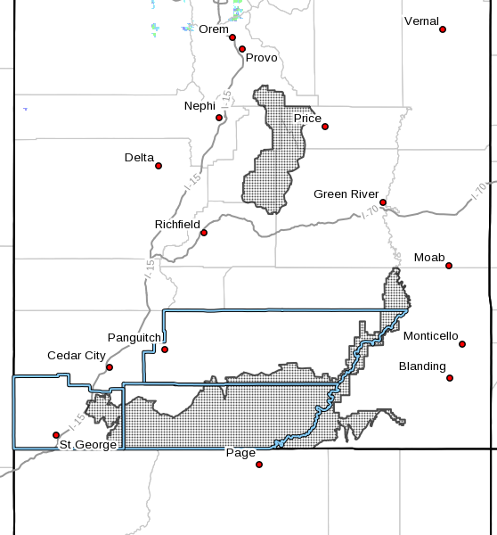
Affected areas include the majority of Washington, Iron, Kane and Beaver counties and portions of San Juan, Garfield and Wayne counties. This includes areas of Manti National Forest, Grand Staircase, Color Country West Desert and Mojave Desert.
Winds

Winds in the affected areas will gust up to 30 mph Wednesday afternoon and reach 40 mph Thursday.
Relative humidity
Afternoon humidity Wednesday and Thursday will be between 5-10 percent.
Other factors
There is potential for isolated thunderstorms and lightning beginning Wednesday afternoon and persisting through late week.
Impacts
Any fires that develop with have the potential to spread rapidly. Outdoor burning is not recommended.
Email: [email protected]
Twitter: @STGnews
Copyright St. George News, SaintGeorgeUtah.com LLC, 2018, all rights reserved.